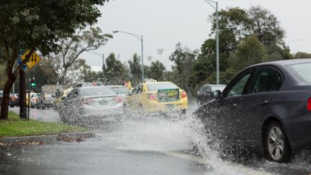
Flood models identify which areas are most likely to flood, how quickly, and how deep the water may get. They don’t create flood risk, but help us better understand the risk that Melbourne faces, now and in the future.
Understanding our flood risk helps us build a safe and resilient city that’s better prepared for flooding – today, tomorrow and for generations to come.
Data used in flood modelling
A flood model is a computer model that simulates the flow of water through drains and waterways. It uses historical flood data and modern mapping technology to accurately predict where flooding might happen now and in the future.
Flood models use a range of information:
Infrastructure data
Roads, levees, drainage systems and waterways all affect water flows.
Natural terrain
This includes soil type, ground height and land use.
Climate factors
Rainfall patterns, rising sea levels, and extreme weather help predict future floods.
Our flood models use the latest modelling techniques and are aligned with national standards.
How flood modelling is used
Flood modelling is an important first step in understanding and managing flood risks. This is because it provides the most accurate and up-to-date information for an area.
Flood maps are one way this information is used. These maps show what would happen in specific circumstances, such as stormwater drains or waterways overflowing in a flood with a 1% chance of occurring in any year.
The flood maps show:
Flood extent (how far water reaches)
This shows where water is likely to spread.
Flood depth (how deep water gets)
This indicates water levels in different areas.
Who this information helps
The information from flood modelling and flood mapping helps many organisations make informed decisions on how to:
- protect communities
- improve drainage systems
- guide regulations on planning and building
- enhance flood awareness efforts.
Examples include helping:
Emergency services
Develop emergency plans to prepare for evacuations and flood response.
Council planning
Update rules and regulations on land use, so that housing and new developments meet flood protection standards.
Communities
Understand their flood risk, how to protect their property and what to do in a flood.
Agencies, including Melbourne Water
Make informed decisions on planning flood infrastructure and drainage.
Flood modelling also helps you:
- Know an area’s flood risk, which can influence your decision to buy or rent a property or renovate your home.
- Protect your home by showing how a flood could affect your property, so you can take action to prevent flood damage.
- Prepare for disruption by showing which roads and buildings could be affected by a flood, including schools, hospitals and businesses.
You may also like...
Flooding and its impacts
Floods are a natural part of our weather cycle. Know the types of flooding that could occur and how they might impact you.
Prepare for flooding
By understanding your flood risk and taking a few simple actions, you can be prepared for flooding.