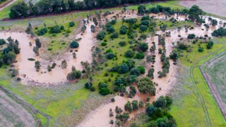
Flood risk in any area depends on how often flooding occurs, how deep and fast floodwater flows and how it impacts people, homes, and infrastructure. Managing this risk means finding ways to reduce both the chance of flooding and the damage it can cause.
Reducing the flood risk involves practical steps to protect our community and environment. These can include:
- Structural measures like building flood walls, levees or drainage systems to help control and redirect floodwaters.
- Non-structural measures such as smarter land use planning, including zoning rules and building controls that help keep people and property out of high-risk flood zones.
Together, these approaches help make our neighbourhoods safer and more resilient to future floods.
- Structural measures
-
Measure type Description Purpose Structural measures Physical infrastructure designed to control or redirect floodwaters Reduce flood intensity and protect built environments Levees and floodwalls Barriers that prevent flood water entering protected areas Protect communities and assets from rising water levels Retarding basins Depressions or dams that temporarily store excess stormwater runoff Delay and reduce peak flood flows Stormwater drains Underground systems that move stormwater away from urban areas Reduce localised flooding in streets and properties Pump stations Mechanically remove water from low lying areas Maintain dry conditions in flood-prone areas - Non-structural measures
-
Measure type Description Purpose Non-structural measures Policies, planning, education and technology measures to reduce flood risk Minimise flood damage using cost-effective and adaptable measures Land use planning Zoning and development controls in flood-prone areas Minimise exposure and damage by guiding safer development Building codes Regulations requiring flood resilient construction Improve structural resilience to flooding Flood warning and forecasting Real-time monitoring and prediction of flood events Enable early warnings and emergency preparedness Community education Public awareness campaigns and flood preparedness programs Empower residents to respond effectively during flood events - Nature-based solutions
-
Measure type Description Purpose Nature-based solutions Nature-based solutions use natural systems and processes to manage flood risk Reduce flood impacts while enhancing biodiversity Wetlands restoration Rehabilitation of natural floodplains and wetlands Absorb and slow floodwaters naturally Urban green spaces Park, rain gardens and permeable surfaces, stormwater harvesting Reduce runoff and improve drainage River channel and floodplain management Maintain and restoring natural river flow paths and storage areas Enhance capacity and reduce blockages
How we prioritise works to protect communities
Our flood risk reduction programs are designed to deliver the greatest benefit to the community. We do this by focusing on areas most at risk. Flooding doesn’t follow boundaries and can affect many places. Because of that, we need to make the best use of limited resources by targeting locations where the potential impact is highest.
To help guide these decisions, we use a measure called Annual Average Damages (AAD). AAD estimates the potential cost from flood damages in any given year at a particular site or specific area, based on different types and sizes of flood events. This helps us compare options and choose flood management solutions that offer the best value, balancing cost with the potential to reduce damage.
While AAD provides a useful financial estimate, we also consider other important factors, like economic, social and environmental considerations as well as the wellbeing of people affected. Not all impacts, like emotional stress or disruption to daily life, can be measured in dollars. These impacts are just as important in shaping our decisions.
Understanding Melbourne’s drainage system and flood risk
Flooding is a natural part of our environment. While Melbourne Water works hard to reduce its impact, it’s important to know that flooding can’t be completely eliminated, especially in older, well-established urban areas.
AAD is reviewed every 5 to 10 years to reflect changes such as inflation, climate change, new developments, improved flood data, and rising property values. This ensures our long-term planning for flood risk management stays up to date with current conditions.
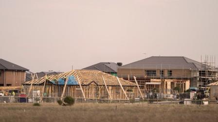
Because public funding is limited, we prioritise investment in already developed urban areas, where flood risk and community exposure are greatest. Other programs are in place to manage flood risk in new growth areas, and we’re committed to regularly reviewing known and emerging flood hotspots to ensure we’re protecting the right places.
The drainage system is not designed to prevent all flooding. Our system is built to manage typical rainfall events, but extreme weather, like intense storms or prolonged rainfall, can overwhelm even the best drainage infrastructure.
Melbourne’s drainage system is built to a high standard and is designed to handle most everyday storms. It performs well during common rainfall events, such as those that occur every 5 to 10 years. However, when we experience larger, less frequent storms, the system may not be able to manage all the excess water, leading to flooding.
We’re committed to reducing flood risk and protecting our communities. This includes:
- Building new drainage infrastructure
- Upgrading and maintaining existing flood systems
- Partnering with local councils on flood reduction projects
- Supporting non-structural solutions like land use planning, flood warning systems and community education
While we can’t eliminate flood risk entirely, we continue to innovate and expand the tools we use to manage it. This includes exploring new infrastructure, using technology, improving planning controls, and working closely with councils and communities to stay prepared.
Climate change and flood modelling
Extreme weather events are becoming more common around the world. In our communities, we’re likely to see more frequent and intense flooding. To prepare for this, we’re now factoring climate change into our flood modelling and planning.
Using national standards, like the Australian Rainfall and Runoff (ARR) Guidelines, and working closely with experts, we’re updating our flood models to reflect future climate conditions. These improved models help us make smarter decisions on investment and land use and flood resilience.
By sharing this new information, we aim to raise awareness about how flood risks are changing and support communities in planning for a safer future.
Residual flood risk
Residual flood risk is the risk that remains after flood risk reduction measures are in place, as no intervention can totally eliminate the risk.
“The community and government need to recognise that living in the floodplain has an inherent risk, and a residual risk will always exist. The level of this risk will vary depending on how exposed the area of the floodplain is to flooding, the development controls in place when the area was developed, and the measures implemented to manage flood risk.” – Australian Institute for Disaster Resilience
Our approach to prioritising flood risk reduction projects
To address these challenges, we have created an equitable, customer-driven sequential flood risk reduction prioritisation process. This process ensures that we use our limited resources effectively and prioritise projects that provide the greatest benefits to the community.
The performance measures used in the prioritisation and evaluation processes are grouped into three categories:
- Community – We consider the disruption and frequency caused by flooding, the vulnerability of the community, and the critical and social infrastructure that may be impacted
- Safety – We look at how effective an intervention will be at reducing the flood risk by analysing the expected changes in flood depth and velocity
- Economic – We consider how effective an intervention will be at reducing the Annual Average Damages (AAD) of flooding to the community, property, infrastructure and roads versus the cost of building the intervention.
Allocating and prioritising funding
The five-year price submission: an overview
Melbourne Water has always invested in flood and drainage projects and will continue to do so. Melbourne Water undertakes a comprehensive five-year price submission process to outline its service programs, priorities and pricing for the upcoming period. This submission, which is made to the Essential Services Commission, is crucial for effectively managing water resources, flood risks and environmental sustainability while maintaining financial cautiousness with our customers.
To ensure our services meet community needs and expectations, we engage with the community throughout the price submission process. This engagement includes surveys, focus groups, public consultations and advisory panels the community gets to provide feedback on priorities and willingness to pay for various services. The feedback collected informs how we allocate our public funds to the various programs and services we offer. To summarise, these price submissions are informed by customer and community needs.
Given financial constraints, it is important to prioritise investments that deliver the most significant benefit in terms of flood risk reduction and community protection.
Flood and drainage projects
Previous flood and drainage projects
- Essex Street Main Drain Rehabilitation project
-
The Essex Street Main Drain plays an important role in protecting homes and businesses in South Yarra and Prahran. It safely carries stormwater away from streets and properties to help reduce flood risk. Originally built in the 1930s as part of Melbourne’s first drainage system, the drain is now nearly 90 years old. With more people living in the area and increased urban development, it needed essential upgrades to keep working effectively. In 2023, Melbourne Water completed the rehabilitation project to improve the drain’s condition and performance. Works included removing trees and roots, replacing concrete decking, patching and filling damaged sections, and carrying out structural repairs such as concrete relining. These upgrades help ensure the drain continues to protect the community from flooding for many years to come.
- Shakespeare Grove Outfall Renewal project
-
The Shakespeare Grove Stormwater Outfall in St Kilda has been part of Melbourne’s drainage system for over 110 years. It helps to safely carry stormwater away from homes and streets to reduce flooding in nearby suburbs. Following routine inspections, we found that the outfall had reached the end of its service life and needed to be replaced. In 2022, Melbourne Water completed the renewal project to upgrade this vital piece of infrastructure. The new stormwater outfall now extends 60 metres into Port Phillip Bay and will continue to play a key role in protecting the community from flood risk for many years to come. The project was shaped through extensive consultation with local stakeholders and the community. As part of the final design, a new public space, the Circle of Reflection Viewing Platform, was created. Suspended above the end of the renewed outlet, this unique feature invites visitors to enjoy scenic views, connect with the marine environment, and learn more about how we manage water in one of Melbourne’s most iconic beachside locations.
- Flood Resilient Guide for Homes
-
In 2020, Melbourne Water teamed up with the City of Port Phillip and James Davidson Architects to create the Flood Resilient Guide to Retrofitting Your Home. This practical guide is designed to help residents living in flood-prone areas make smart changes to their homes so they can better withstand flooding and bounce back more quickly after an event. A flood-resilient home is built or modified to reduce damage during floods, making it easier for families to return to normal life sooner. The guide also emphasises the power of working together. By combining efforts from government, businesses, and households, we can build stronger, safer communities and infrastructure. This initiative was part of the Elster Creek Collaboration, launched in 2017 to tackle local flood challenges through a catchment-wide approach.
- Flood protection for Murrumbeena to Malvern East
-
In early 2020, Melbourne Water completed a major flood mitigation project to help protect homes and businesses in Murrumbeena and Malvern East. The project involved building a new underground stormwater drain, 2 kilometres long and 1.8 metres wide, stretching from Railway Parade in Murrumbeena to the Monash Freeway in Malvern East. This new drain was designed to reduce flood risk in areas that had experienced serious flooding in 2006 and 2011. Delivering the project in a busy urban area came with challenges. Construction involved crossing the Glen Waverley railway line and major roads, removing some trees, and working in narrow residential streets, bringing construction close to homes for nearly two years. We worked closely with residents, businesses, and stakeholders to manage disruptions and minimise impacts, especially around road and rail closures. Beyond flood protection, the project also brings long-term benefits to the community. By lowering the railway embankment that once divided Murrumbeena, the area now enjoys better access to parks and green spaces, helping reconnect the neighbourhood and improve quality of life.
- Retarding Basin Upgrade Program
-
Between 2016 and 2017, Melbourne Water upgraded the embankments of 28 retarding basins across the region. These basins play a vital role in flood protection by temporarily holding stormwater during heavy rain and releasing it slowly, helping to reduce the risk of flooding in downstream communities. All upgrade works were completed in 2018, improving the strength and reliability of these basins so they can continue to perform well during major weather events. This program is part of our ongoing commitment to maintaining essential flood infrastructure and keeping communities safe.
- Frankston drainage improvement works
-
Between 2009 and 2013, Melbourne Water carried out a major drainage upgrade in Frankston to help reduce the risk of flooding across the area. This project included building several new stormwater drains, including a large 2.5-metre-wide tunnel stretching from Monash University to Kananook Creek. Frankston is one of Melbourne’s lowest-lying suburbs and has experienced serious flooding during heavy rain in the past. This upgrade was designed to improve flood protection for local homes, businesses, and the central business district; helping to keep the community safer during future storm events.
Current projects and studies
- Current flood and drainage projects
-
Lilydale drainage assets - ongoing maintenance works
Port Melbourne drainage pump station upgrade
Waverley Road retarding basin spillway upgrade
- Current flood studies
-
Acacia Street Main Drain, Glenroy
Alister St, Fitzroy North
Bluenose Creek, Wesburn
Brandon Park Drive, Wheelers Hill
Carronvale Road, Mooroolbark
Chinamans Creek, Rosebud Murray Anderson Creekk, Rosebud
Connor Court, Ballan
Fishermans Creek, Mornington
Grove Street Main Drain, Eltham
Maribyrnong River catchment flood mitigation study
Nunawading Outfall, Monash
Ormond-McKinnon, Glen Eira
Richmond Quarry Main Drain (Glass Street, Richmond)
St Helena East Drain, Ethan North
Note that most of the studies do not have a current webpage at this stage.
You may also like...
Prepare for flooding
By understanding your flood risk and taking a few simple actions, you can be prepared for flooding.

Flooding information and advice
Plan ahead. Understand the impacts of potential flooding on your plans to buy, sell, build, renovate or develop.
Flood planning controls explained
There are four types of flood planning controls where you may need our consent before your council will issue a planning permit.

Building and home renovation
Before you start building, renovating or sub-dividing, make sure your plans meet our criteria for flood, water asset and waterway protection.