Return to search results
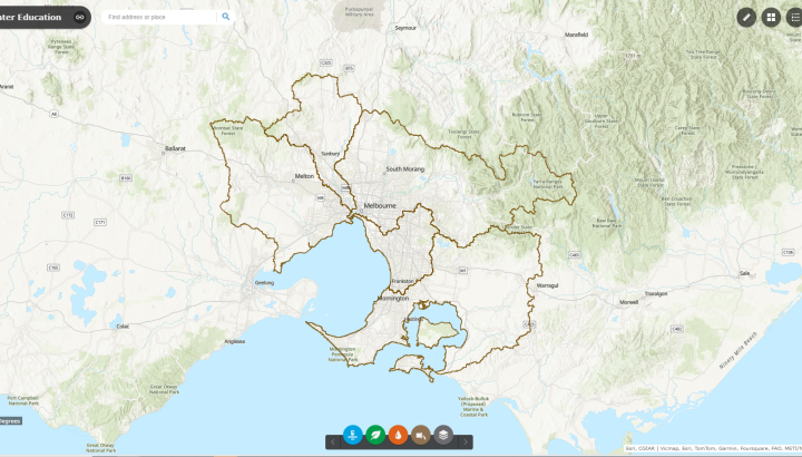
Melbourne Water GIS map
A GIS map uses data organised in layers of information. By turning layers on and off, data and information is revealed, and patterns and relationships can be analysed.
Use this Melbourne Water Asset map to trace networks of water, sewerage and drainage pipes that keep our city running, or find your nearest waterway, wetland or dam.
Please note: This Map is provided for Educational purposes only. Information displayed may not be current and should not be relied upon for development, design or planning purposes.
Learning outcomes
- Navigate a GIS map including turning layers on and off and using a measuring tool
- Analyse a GIS map to develop explanations and draw conclusions
- Explain the spatial distribution of Melbourne Water assets
Instructions
The Melbourne Water Asset map includes the following information and tools. You can use the GIS map to show features or use one of our lesson plans (see downloads).
Information and asset layers includes:
- Catchments, Rivers, Retarding Basins and Wetlands
- Water Supply
- Flora and fauna
- Sewers and sewerage
- Registered Aboriginal Parties
Measuring tools: Area, Distance ruler and Location
Victorian Curriculum v2.0
Geography
- Year 7&8: VC2HG8S02, VC2HG8S03, VC2HG8S04, VC2HG8S05
- Year 9&10: VC2HG10S02, VC2HG10S03, VC2HG10S04
- VCE Geographical skills: Analysing geospatial information & Map use, interpretation and analysis