A 3D hydrodynamic model of the treated wastewater discharge environment at Boags Rocks is helping assess impacts on the near-shore environment and associated aquatic ecosystems, and inform biological monitoring programs and research activities. Read the case study to learn more.


Sustainable Development Goals:
Goal 6: Clean water and sanitation
Goal 14: Life below water
Background
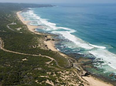
Our Eastern Treatment Plant at Bangholme receives and treats over 350 million litres of wastewater per day. While some of the treated water, called Class A recycled water, is used on site or provided to nearby customers, the rest of the high quality recycled water is released into the ocean via the South Eastern Outfall (SEO) at Boags Rocks, Gunnamatta.
This outfall is a shoreline discharge and the second largest ocean outfall in Australia. Under the Environment Protection Authority (EPA) Victoria guidelines, we must demonstrate that this discharge to the ocean does not negatively effect the local marine environment. A multiple lines of evidence approach is the preferred way to demonstrate this.
Project focus
A 3D hydrodynamic model was developed for the SEO discharge environment at Boags Rocks to compliment traditional monitoring, which is based on taking and analysing water samples. The model uses the Aquatic Ecosystem Model 3D modelling platform, which simulates the behaviour of water over time based on environmental forcing – the effect of the wind, waves and tides. It also shows the fate and transport of the discharged water once it leaves the SEO.

To capture the dynamics of the water movement around the discharge point, we needed to incorporate a significant section of coastline in the model domain. A small-scale nested grid was also included to ensure the nearshore environment was adequately modelled. To force the model, the best available data from the Bureau of Meteorology, including wind, waves and tides, was used.
The modelling platform is one familiar to specialist modellers within Melbourne Water, so assessing the impacts of changes in discharged water quality and quantity can be done in-house.
Outcomes
The model will be used to assess the “current and future impacts of the outfall” on the near-shore environment and associated aquatic ecosystems, and inform biological monitoring programs and research activities. It will also help to demonstrate our compliance with the mixing zone requirements as set out in our discharge licence.
While the project aimed to develop a detailed and calibrated model that we could use as a decision support tool for strategic planning and scenario assessment, its ultimate goal is to ensure that the area around the SEO continues to enjoy good water quality, thus maintaining the biodiversity of the area.
You may also like...
Delivering on the Sustainable Development Goals
This report outlines Melbourne Water's unwavering commitment to advancing sustainability through the United Nations Sustainable Development Goals (SDGs).