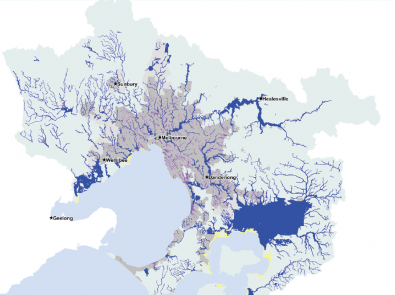
The Flood Management Strategy for Port Phillip and Westernport sets the 10-year direction for flood management in the region.
The strategy is guided by a collective vision, objectives and 10-year outcomes. Under each outcome, the strategy identifies key focus areas which will guide our actions. The strategy will be delivered by partners that have flood management responsibilities, including:
- local and state government
- water authorities
- emergency services
Partners will take a collaborative approach and work together to plan for, avoid and reduce flood risks while supporting emergency preparation and response.
Why we need a strategy
As the region’s floodplain manager, our role is to coordinate delivery of the strategy as required by the Victorian Government’s Floodplain Management Strategy. We all need to work together with the community to reduce the impacts of flooding, which poses risks to people, property, infrastructure and the environment.
Flood impacts can include:
- deaths
- injuries
- property damage
- social disruption
- loss or disruption of critical infrastructure and services.
Climate change, sea level rise and urban densification are increasing flood risk. Despite an overall decrease in rainfall, climate scientists are projecting:
- more frequent and severe floods
- more intense rainfall events
- continued sea level rise.
Flood Management Strategy and Action Plan
Annual Report
Progress against the strategy's actions is reported at the end of each financial year. The Annual Report provides key insights on the progress on the Flood Management Strategy focus areas during the year.
Contact
For more information, email [email protected]