We track the condition of Melbourne’s rivers, creeks and wetlands so we’re aware of any changes – or if we need to adjust what we’re doing to look after them. Learn how we assess river health and view data for catchments across Greater Melbourne.
How healthy are our waterways?

Melbourne’s waterways vary greatly in condition: the more natural areas upstream are generally healthier than those downstream, due to the impacts of urban development.
The good news is that compared to other major cities, our waterways are in good health overall. The Yarra River has greatly improved since the 1970s – when it was a dumping ground for industrial waste and sewage – and pollution levels have not significantly changed despite Melbourne’s rapid growth. This is a big achievement, as every new driveway and pavement increases the amount of stormwater that runs off into our rivers and creeks, carrying litter and pollutants with it.
How we assess waterway health
One of the main ways we assess waterway health is by looking at the key values they support, which reflect their environmental, social, cultural and economic importance. These values are in turn supported by waterway conditions: the overall state of the waterway and key processes vital to its ecosystem.
This means that improving waterway conditions improves waterway values – and the various benefits a waterway provides. And by monitoring, we can agree on the priorities and locations most likely to result in sustainable and long-term waterway improvements.
Key values
Not all waterway features can be effectively assessed and tracked. Through a collaborative and scientific process, we’ve chosen nine key values as representative measures of the environmental and social benefits waterways provide, as well as their importance to the community. They are:
- fish
- platypus
- frogs
- birds
- macroinvertebrates
- vegetation
- amenity
- community connection – with each other and nature
- recreation
We rate these values from ‘very low’ to ‘very high’ across a system of waterways, which balances out differences in waterway characteristics that allow some to better support key values than others. This means the health of your local waterway may not always change, even if the overall system improves.
Waterway conditions
Rivers, wetlands and estuaries each have a different set of conditions that support their environmental values: from their physical shape and vegetation, to the amount of water that flows through them.
There are also conditions that support social values, such as access to waterway corridors, litter and community involvement in waterway health activities.
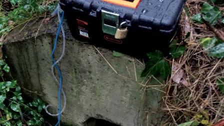
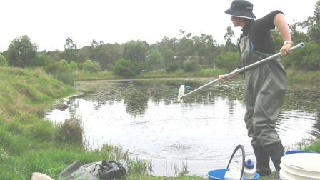
Water quality

Water quality an important condition that supports both environmental and social values. We sample water at over 100 monitoring sites to assess any changes over time, testing for a range of indicators including:
- water temperature
- dissolved oxygen
- salinity (salt levels)
- pH level (acidity or alkalinity)
- nutrients (forms of nitrogen and phosphorus)
- faecal contamination (E. coli)
- metals (arsenic, cadmium, chromium, copper, lead, nickel and zinc)
In summer we also test key recreational sites weekly for E. coli and blue-green algae, which can cause skin irritation or illnesses for people and pets that come into contact with the river. Our monitoring results are used to calculate the EPA’s Yarra Watch forecasts, with a summary also available in the EPA’s annual report cards.
Our data is also shared with the Department of Environment, Land, Water and Planning, who audits any changes to our monitoring network and sets policies and objectives for improving river health. It can be downloaded from their Water Measurement Information System.
You may also like...
View annual progress towards 10-year targets for waterways across the Port Phillip and Westernport region, as set out in the strategy.
Water quality monitoring
Volunteer as a Waterwatch water quality monitor, and collect data to help your local river or creek.
Lightweight filters reducing heavy sampling loads
Case study: we partnered with Monash University to trial continuous-flow ultrafiltration samplers, which provide a safer way to understand the quality of water in our waterways.